


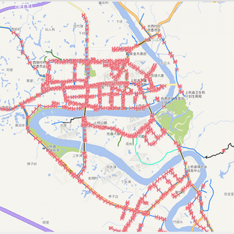
Pipe network geographical information GIS system
The pipeline network geographical information GIS system can establish a resource database of user equipment and facilities resources, realize graphical editing, query, statistics, and analysis functions. It also provides a wealth of pipeline network analysis methods and methods, including burst pipe analysis, connectivity analysis, Cross-section analysis, pipeline collision analysis, two-point tracking analysis, etc. provide users with the required information for production planning and daily management, and realize visual management of resources.
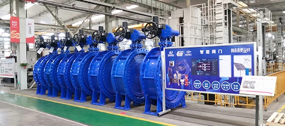
Product Details

Leave your messages
Related Products
Submitted successfully
We will contact you as soon as possible
Close


